Collaboration
How The Greater Copenhagen Fire Department Improves Emergency Preparedness Training with Weave Maps

Weave Reality
|
3
minute(s) read
From static PowerPoints and stationary tactical boards to significant opportunities in 3D maps. With the help of Weave Maps, fire constables at The Greater Copenhagen Fire Department can now practice complex scenarios directly in their own district - spontaneously and easily - without leaving the station.
Jakob Habeck, Deputy Emergency Preparedness Inspector in the Department of Learning and Education of The Greater Copenhagen Fire Department, shares his thoughts on what it has been like to start using Weave Maps.
The Challenge: Logistics and Planning as a Barrier to Good Training
Traditional emergency preparedness training for the fire department has often been linked to physical locations. People gather in a classroom with a PowerPoint, use large, stationary physical models, or travel to a given location for a go-through "on site". For a busy fire department in an operational everyday life, the logistics behind a discussion exercise can therefore often become a barrier to how often they get to train. Jakob Habeck explains:
"For us, planning a new scenario has been a process. It requires us to create a case, collect and compile material, and set up a PowerPoint or plan how to use our physical model. This often makes it difficult to be spontaneous or to be able to train with enough variation."
He continues;
"The barriers we experienced contributed to our wish to find a solution that was more mobile and could be used more easily without major processes beforehand or along the way."
The Solution: The Whole World Available in 3D Maps
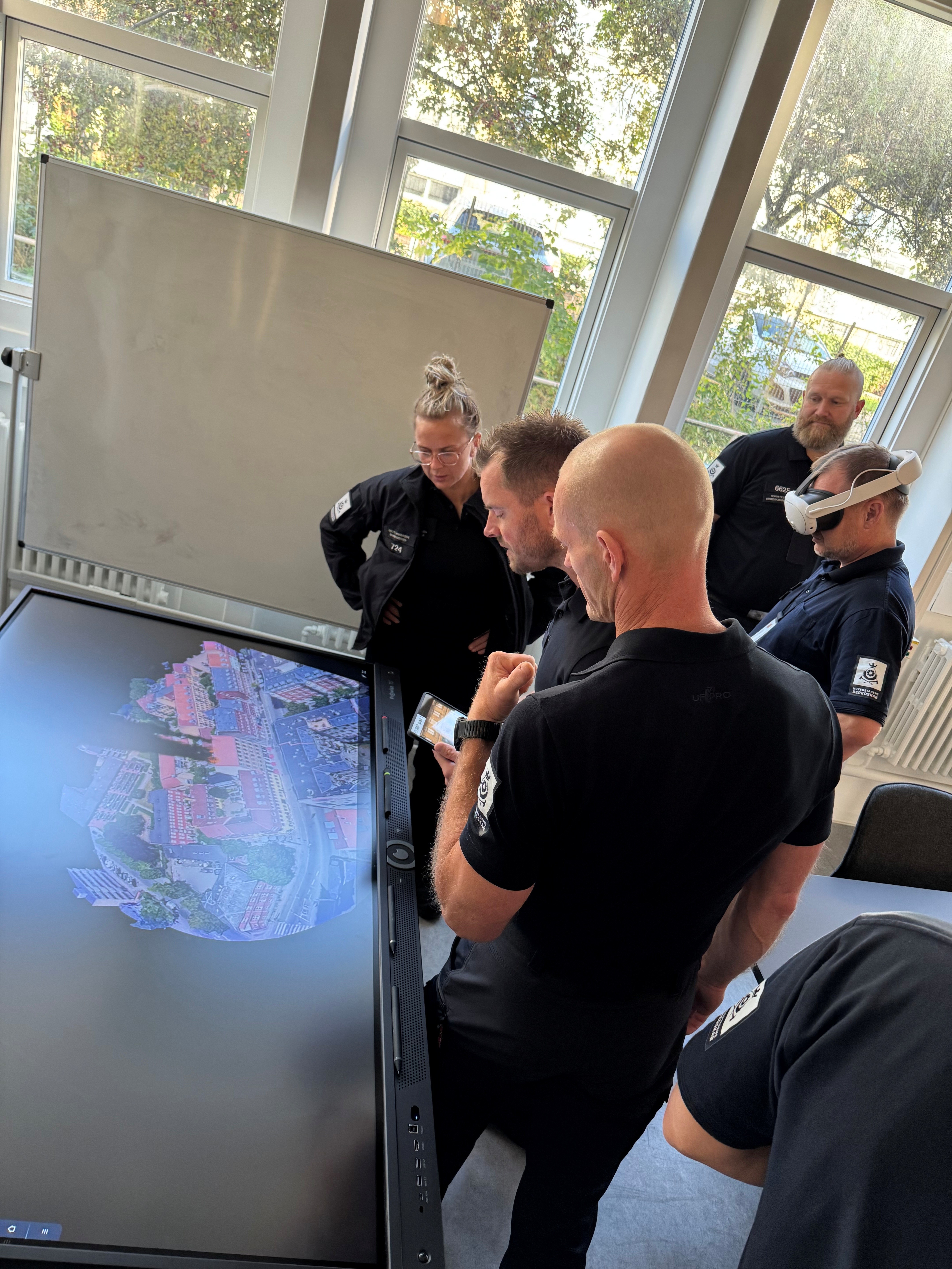
After exploring what was available on the market and testing various solutions, The Greater Copenhagen Fire Department finally chose Weave Maps. They felt that the solution offered new opportunities and met their needs. By moving the entire discussion exercise onto a 3D map, the training became both more accessible and more realistic. With the help of precise map data, the crews can now train at exactly the addresses and buildings they actually respond to.
"With a 3D map that functions as a copy of reality, it is easier to make the training more relevant, exciting, and varied. You can suddenly train specifically on the buildings you are set to protect. And you don't have to spend as much time on logistics and planning to achieve a good exercise."
Furthermore, Jakob adds:
“What makes Weave Maps extra exciting is the possibility of moving down to street level. This means you have both a tactical board where you can work with real addresses and buildings from above, but you can also go down and stand in front of the building. When a situation assessment is to be made, it will always be from street level, and therefore it is more realistic to stand in front of the object itself.”
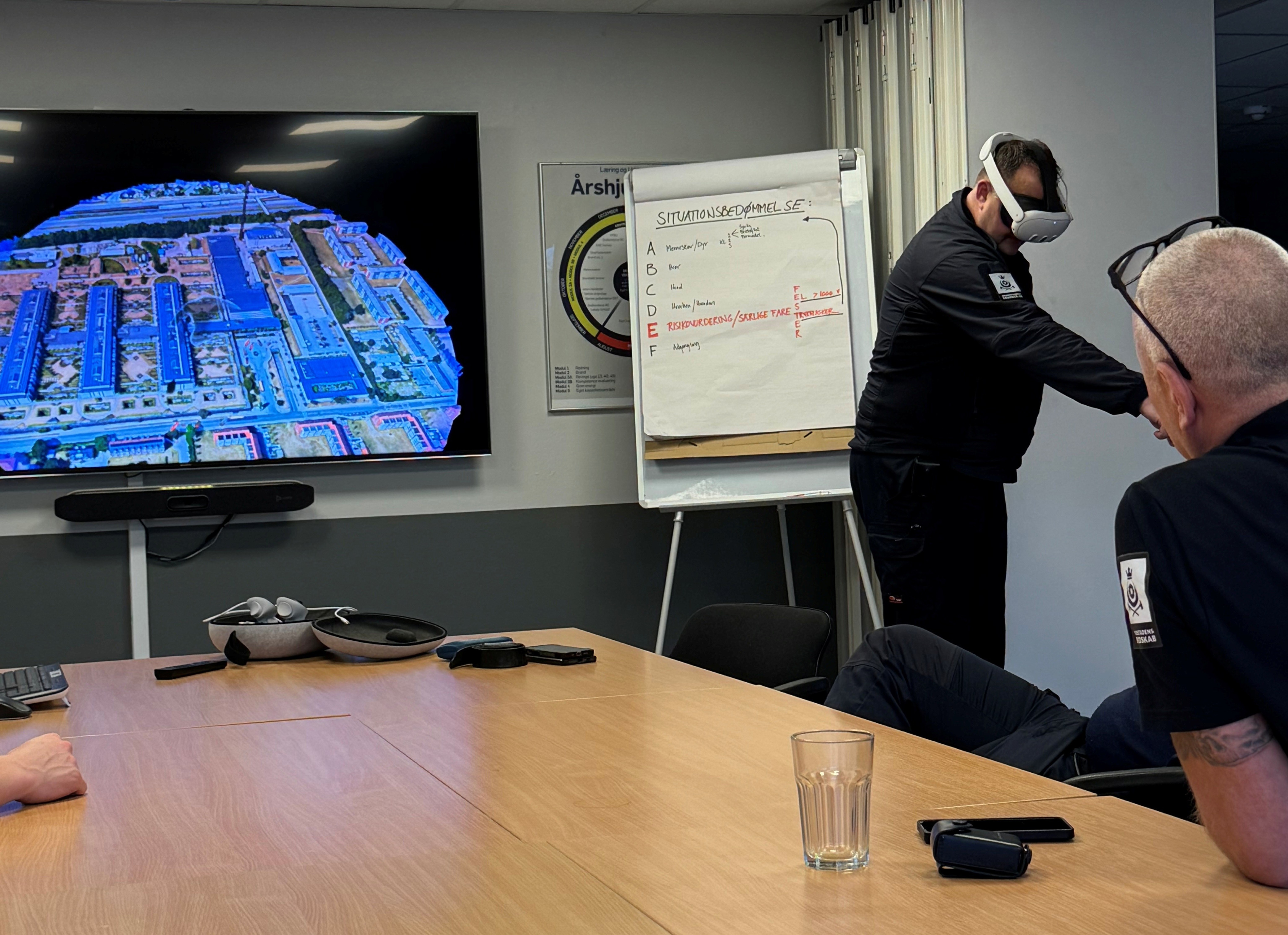
You don't need VR glasses to use Weave Maps. You can also cast a scenario to a screen or view it from your own PC.
The Result: More Training, Better Quality
Although the fire department is still in an early phase, they are already starting to see results. By removing the logistical obstacles, everything is in place for the watch teams to train more frequently.
"The fact that the solution is so easy to use means you have the opportunity to train more often and with greater variation. You can achieve a lot in one hour. And you can more easily do it within the individual watch teams or out at the various stations. Just having the opportunity more readily available is a big step in the right direction for our preparedness."
Jakob follows up on how they use Weave Maps more specifically:
"It is still early, and we are constantly discovering new ways to use Weave Maps, but today we use Weave Maps especially for the training of team leaders. The various fire stations and watch teams use Weave Maps to look at objects in their district and talk about the challenges and opportunities that exist with different objects."
The Future: AR and Real-Time Use
When we talk about the future of the solution, Jakob immediately becomes enthusiastic. At The Greater Copenhagen Fire Department, they already have a long list of ideas and wishes for how Weave Maps can be taken even further.
"We appreciate that there is such a short path from an idea to setting up an early version of something. There is a lot of exciting stuff you can do with this solution in the time ahead. For example, we are excited to see if AR (Augmented Reality) can be introduced to enable the use of glasses "on site". That you can stand in front of a building and manipulate what you see by placing markers and objects. That would be cool."
Jakob continues;
"We are also excited about how we can use Weave Maps for evaluations or debriefings from sharp situations. And in the long term, use the solution in real-time, during a sharp incident. There are clearly many exciting possibilities here."
At Weave, we work with fire departments of all sizes. Do you want to see how Weave Maps can simplify training at your department? Contact us to learn more.